Background
The
Barrington Atlas of the Greek and Roman World was published in 2000 as part of an international effort to create a comprehensive map and a directory of all ancient places mentioned in sources and a selection of important archaeological sites. Since then two digitization efforts based on the Barrington Atlas have come into being,
Pleiades, which started off as a historical gazetteer,and the
DARMC project, which is a layered historical atlas. In 2010-2011, as part of a common project, the geodata of DARMC was transferred to Pleiades, though, unfortunately, not all the places in the original Barrington directory could be matched between DARMC and Pleiades, resulting in many places without precise coordinates and feature data. Nonetheless, ever since, the Pleiades gazetteer has had the ability to display most ancient places on a map, individually and with their immediate surroundings, using Google Maps API and Google Maps as background layer.
In March 2012 the
Ancient World Mapping Center launched a first version of an online GIS application called
Antiquity À-la-carte, covering the entire Greco-Roman World. This application is also based on the Barrington Atlas, on geodata from Pleiades/DARMC, and its own digitization efforts (roads, aqueducts, ancient coastlines).
Yet, while the DARMC and Antiquity à la carte initiatives provide geographical coverage and exiting possibilites to compose custom maps in layers, until now there has been no digital map that can be used as background layer for use in a fashion similar to modern mapping applications like Google Maps. Thanks to Pelagios, this is work that I have undertaken, with a view to aiding any archaeological or historical research interested in or using online mapping. We are releasing the map with a CC-BY license, allowing anyone not only to browse and consult it but also to use it for representing their own data or to build on it their own applications, provided that they include a proper scholarly attribution. What is more, the map can be used with OpenLayers, Google and Bing maps, so that anybody, who already has these systems in place, can easily swap out the map tiles for these historical ones.
To see the basic background map (using Google Maps API), click
here (default setting is Rome, zoom level 7 of 11). For information about the making of the map, sources of geodata, and a legend to the symbols, click
here. For those of you interested in finding out about how the map came into being, keep reading!
Aim
The aim of my work with Pelagios has been to create a static (non-layered) map of the ancient places in the Pleiades dataset with the capacity to serve as a background layer to online mapping applications of the Ancient World. Because it is based on ancient settlements and uses ancient placenames, our map presents a visualisation more tailored to archaeological and historical research, for which modern mapping interfaces, such as Google Maps, are hardly appropriate; it even includes non-settlement data such as the Roman roads network, some aqueducts and defence walls (
limes, city walls). Thus, for example, the tiles can be used as a background layer to display the occurrence of find-spots, archaeological sites, etc., thereby creating new opportunities to put data of these kinds in their historical context.
The ancient places and their names have been rendered on a topographical map created from elevation data, originally from the Shuttle Radar Topography Mission (SRTM) project at NASA. The map itself is created as a tiled mapset in the Spherical Mercator projection (
EPSG:3857), used by most webmapping services. It is compatible with Google and Bing street and satellite maps,
OpenStreetMap, and can easilly be implemented with a javascript application programming interface (API), such as
Google Maps and
OpenLayers API. Work has taken two different forms: 1) preparation and improvement of the data; and 2) the rendering of the digital map. I elaborate on each item below.
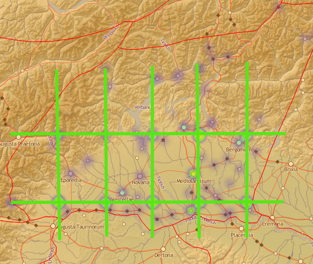
Rome and Central Latium at zoom 9, click to display the full image.
Limitations
In a departure from the original Barrington Atlas and the Pleiades dataset, our digital map does not try to implement time periods when places are attested, nor does it speculate on the certainty (or otherwise) of locations: only precise locations from the Pleiades dataset can be rendered on the map. Nevertheless, since many places lacked precise coordinates and/or feature data, a good deal of effort has been made to improve the data. For sake of clarity, we have displayed only one of an ancient place's possible names, based on its primacy and importance in the Barrington Atlas. The digital map is presented at eight different zoom levels (3-10: zoom 10 corresponding to a scale at approx. 1:500,000), and one additional zoom level (zoom 11, which corresponds to a scale at 1:300,000) for maps of Central and Southern Italy, Northern Tunisia, Greece, Turkey, Syria, Lebanon, Israel, Palestine, Egypt and Jordan. Due to the lack of precise coordinates in the original dataset for regions, cultural (tribes, people) and natural features (mountains). thus far only places have a complete rendering on the map, while major rivers and lakes have been labelled with Latin names.
These considerations have been made to keep the map simple and easy to understand, which is a necessity for online publications, especially for interactive maps that users may want to click on, pan and zoom.
Licence
The transmission of the tiles to any web-mapping application is permitted under a
Creative-Commons 3.0 (CC BY-SA) licence. Attribution to the Digital Atlas of the Roman Empire (DARE) project at http://dare.ht.lu.se is required and linking to this blogpost is encouraged. See below for implementation instructions.
Making of the map
There is a short description how the map was made at a
separate page. Here you will also find the legend of the map and a listing of datasources for the geodata of the map. The map can be viewed in
fullscreen mode at this page.
Preparation and improvement of the dataset
Georeferencing the Barrington Atlas
The Barrington Atlas used maps at three different scales. The central Mediterranean provinces of the Empire were rendered at 1:500,000, which corresponds to zoom level 10 on the digital map (which is 1:545,979 to be exact), peripheral provinces like Britannia, Germania, Belgica and Gallia were rendered at 1:1,000,000 (zoom level 9). There were also special maps of Rome, Carthage, Athens, Constantinople and their surroundings at 1:150,000 scale (zoom level 12). The accuracy of georeferencing the 1:1,000,000 scale Barrington maps, given that the places are located correctly on the printed map, is around 3 kilometers, which is illustrated in the online example 1, where georeferencing using different sources of information is described.
Example 1:
Georeferencing the sanctuary Sanxay, dep. Vienne, France using different sources.
Over the past few years, the conditions for successful georeferencing of ancient places has increased. Nowadays there is better satellite imagery; national mapping agencies offer APIs to quality maps (e.g.
Géoportail, IGN, France and
OpenSpace, Ordnance Survey, Great Britain); georeferencing services have better accuracy, with the result that e.g.
Google Maps Geocoding Service can return places that aren't even visible on their own maps (e.g. small hamlets); main archaeological monuments throughout Europe and the Middle East have their own articles on Wikipedia, often with highly accurate coordinates; national heritage agencies offer online database services, etc.
Additional data from Barrington Atlas
From the beginning it was clear to me that, since we were creating a map, we would require information that was not included in the original Pleiades dataset, and also that it was necessary to render ancient and modern placenames in a different way. One such example was the relative importance of a place. In the Barrington Atlas, places were represented in a hierarchy of importance through the use of font and its size, so that, for instance, those places considered of greatest significance - capitals, settlements with the legal status of
colonia and
municipia, legionary bases, important sanctuaries and mines - were rendered using capital letters. On our map, we let those places appear first, so that users can immediately locate themselves in the landscape and grasp at a glance those places which have greatest prominence in our sources.
The Barrington Atlas and the use of font and font-size to indicate relative importance among places. Minturnae (Minturno, Italy) is the most important place on this map, allthough all placenames with capital letters (Sinuessa, Suessa Aurunca and Interamna Lirenas) are assigned to the category of major settlements on the digital map.
After careful and repeated study of the Barrington Atlas, I found a total of 1488 places indicated as important on the map by its font and size (capital letters), mainly settlements, but also legionary fortresses, rural sanctuaries (in fact there are three of them, all Greek: Olympia, Nemea and Isthmia), to a residence, the
villa of emperor Hadrianus, near Tivoli (outside Rome). In our dataset, these places have been assigned a major/important property allowing them to appear on the map before other places (i.e. at lower zoom levels) and depicted with bigger symbols and font. Even given the time restriction of the project, we decided that it was important to get the features and coordinates of these places as accurate as possible. Some belonged to those cases where Pleiades and DARMC had trouble aligning their datasets, especially those places sharing the same ancient name. For instance, only one of the two important places in Britain names
Isca had precise coordinates in the Pleiades dataset (that named
Isca = Caerleon, Exeter), and only one of three of the cities (that named
Venta = Caerwent, Winchester, Caistor-by-Norwich).
Implementation of the map
I have prepared two simple examples of the implementation of the background map, one using the Openlayers API,
example 2, and the other using Google Maps API,
example 3. (Feel free to study the HTML code, which contains all the Javascript. The path to the directory on the Pelagios server where the tiles are stored is located at
http://pelagios.org/tilesets/imperium/{z}/{x}/{y}.png
Implementation in Google Maps uses the
ImageMapType class, which is used to define a custom map type with the same behaviour as the default map types, whereas implementation in OpenLayers uses the
Layer.XYZ class. The path must be specified in the JavaScript code, see the documentation for details.
There are several ways to get your data on the map, though it is beyond the scope of this article to go into the detail. The simplest way is just to place a marker at a specific location on the map: with its political and cultural infrastructure, our presents offers a favourable comparison to modern streetmaps in the display of information. Another popular way is to load a
Keyhole Markup Language (KML) file into your webmapping application. This is demonstrated in
example 4 (OpenLayers) and
example 5 (Google Maps), where a KML-file containing the Roman milestones in Western Continental Europe is loaded.
I have set up a fully interactive implementation of our digital map at
dare.ht.lu.se. The web application uses the OpenLayers API. There is a two way interaction between the map and a backend SQL database, containing data about the ancient places. Information about the places can be retrieved in three different ways:
- directly, by clicking the symbols on the map;
- listing the places currently displayed on the map;
- by entering a search expression of an ancient or modern name or part of a name.
Results of your query appear in the right sidepane. It is also possible to display a detailed view of the site using Bing Satellite Maps or OpenStreetmap.
Conclusion
This is the first version of a digital map inspired by the majestic Barrington Atlas. Our map cannot really do it justice, first because of the complex nature of the original, second for the reason that much work remains to be done, with respect to both developing digital mapping techniques and to improving the quality of the feature data. In another way, however, this map goes beyond the scope of the Barrington Atlas, because - as a digital product - it can be expanded to much higher zoom levels and be connected interactively with users, other maps and georeferenced data of any kind (plans, drawings, photos, etc.)
For the future I envisage more places being included in the database: a digital map has no restriction in space, whereas the Barrington Atlas was constrained by the physical size of its pages (which even then were big, as any owner of the Barrington knows!). In this version I have stopped at zoom 11: however the freely usable OpenStreetMap continues to zoom 18 and already contains highly accurate data about the structure and shape of many archaeological sites. In addition, the OpenCycleMap, among others, has shown that elevation data from the SRTM dataset can be rendered at zoom level 14 with some interpolation. Finally, national agencies (e.g. IGN, France) are continuing to release land-use data that are being incorporated in the OSM dataset. Therefore I see a growing archaeological map of the Ancient World, not only a historical map.
Meanwhile the author is looking forward to hearing about your experience of this map, so that together we can improve our understanding of ancient world geography using twenty-first century technologies.
This work has been supported by the Pelagios project, and I would like to thank Leif Isaksen, Elton Barker and Sean Gillies (Pleiades), who provided ideas, support and feedback.
Johan Åhlfeldt
Digital Atlas of the Roman Empire (DARE)
Department of Archaeology and Ancient History, Lund University, Sweden